North: Cape Chelyuskin, Krasnoyarsk Krai
Coordinates: (77°43'N)
Elevation: at sea level
Cape Chelyuskin, the northernmost point of the Russian mainland, is hardly a welcoming place: bare and wind-swept, it exists in a permanent winter. Here, it snows every month of the year. And if that doesn’t make you want to go there, wait ‘till you hear about the polar bears!
Situated only 1,371 kilometres from the North Pole, the cape bears the name of the famed 18th-century Russian polar explorer Semyon Chelyuskin. And in 1919, it was visited by the famed Arctic explorer Roald Amundsen on his six-year journey through the Northwest Passage. Today, it’s home to a hydrometeorological station that’s typically staffed by only 6 to 8 researchers. Sounds like a fun time!
South: Ragdan, Republic of Dagestan
Coordinates: (41°12'N)
Elevation: 3,500 meters above sea level
The highest point on our list is located in the Greater Caucasus mountain range, on the border between Russia and Azerbaijan. While the neighboring Ragdan peak is in fact 4,200 meters high, the border between the two countries passes just nearby at a slightly lower altitude.
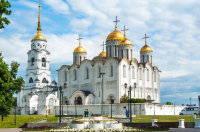
On the Russian side of the border, this particular part of the Greater Caucasus lies in the Republic of Dagestan, a mountainous region that’s home to one of the country’s most common languages.
West: Lavry, Pskov Oblast
Coordinates: (27°19'E)
Elevation: ~170 meters above sea level
Despite being on the very edge of the country, right near the tri-border point between Russia, Estonia, and Latvia, much of the area around the village of Lavry has the appearance of quintessential Russian countryside: cutesy wooden huts, rolling hills, lush forests, and bubbling creeks.
As in all such places, the historical diversity of the local populace is quite literally set in stone; in this tiny village of ~1,000 people, a quaint wooden Russian Orthodox church sits not far from a historical Lutheran church once built for the region’s Latvian inhabitants.
East: Cape Dezhnev (East Cape), Chukotka Autonomous Okrug
Coordinates: (169°40'W)
Elevation: 50-70 meters above sea level
Cape Dezhnev, or Dezhnyov, is named after the Russian explorer Semyon Dezhnev (those Semyons sure loved to explore!) who mapped it in 1648; sometimes, it is also referred to as “East Cape,” a name bestowed on it by the famed James Cook a century later. Its third common moniker is “the east end of the world” – after all, this is where the world seems to “end” on most world maps.
In the 19th and early 20th centuries, this was a common trading point for whalers, fur traders, and native Yupik and Chukchi people. But humans have been present here for far longer – just a short trek away from the cape, you’ll find Ekven, a protected Stone Age settlement and burial site. Currently on the tentative list of Russia’s UNESCO World Heritage Sites, it contains artifacts and remains that have been dated to as far as 200 BCE!