Vernacular regions
Vernacular regions are a city’s distinctive areas that are defined by local citizens through their daily activities. They often differ from administrative units, as they reflect the real practices of interacting with the urban environment: district’s historical identity and borders formed by the morphology of urban development.
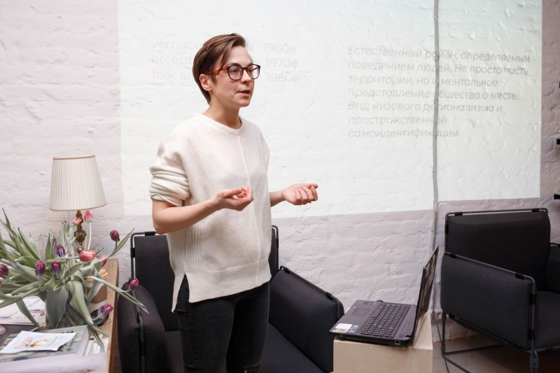
According to Alexandra Nenko, an associate professor at the Institute of Design and Urban Studies, the term emerged in the 1960s, when such regions were also called “perceptional” or “folk”. It gave start to the notion that borders of districts have to be defined by not the decisions of administrative agencies but rather by citizens who live there.
For example, French philosopher Guy Debord said that a city is not a structure of streets and squares that can be mapped once and for all, but a dynamic flexible structure of particular districts, each with its own atmosphere. He and his comrades looked to experience this atmosphere during their “drifts” around the city.
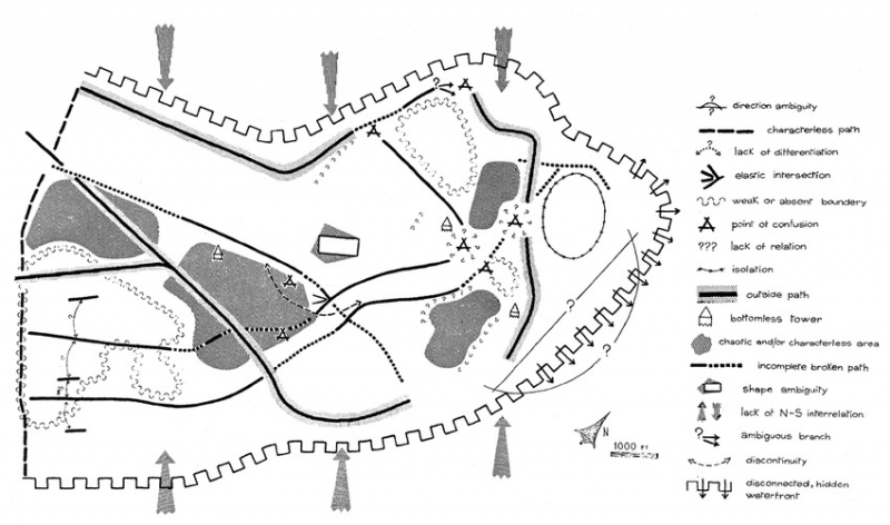
Kevin Andrew Lynch, a renowned urban planning specialist, placed much focus on a city’s visual image. He proposed the idea of the “mental image” and “mental maps”. Mental images are images that are recognized in a similar manner by large numbers of citizens. Mental maps are maps that are created by a person’s subjective perception and can be used to follow one’s daily routes and ways of interacting with the urban environment. Kevin Lynch believed that these concepts can help understand the nature of particular locations of a city, for example, territories near places that we visit regularly, like shops or pharmacies.
Another important factor in forming vernacular regions are sights, and that includes not only major landmarks like the Hermitage or the Alexander Column, but also local elements of public art.
On studying vernacular regions
Mental maps were used as a basis in a recent research by Omsk specialists. In their project, they used the structure of popular toponyms, i.e. the unofficial names of districts used by local citizens.
Another project that focused on analyzing a city’s emotions is the Imprecity platform by the Quality of Urban Life Lab at ITMO University’s Institute of Design and Urban Studies. This is an interactive website dedicated to St. Petersburg parks, streets, squares, embankments and other public spaces. Its citizens and guests can use emoticons to share their perception of different locations and leave explanatory comments.
This data is used by Impercity’s analysts to draw emotional maps and compile rankings of places so that people would know where they can go to brighten up their mood, and which places are best avoided and why.
“Emotions can show locations that inspire happiness, as well as derelict spaces that people don’t want to visit or a completely indifferent to. For example, our data shows that the most “emotional” location in St. Petersburg is the island where New Holland is located. What’s more, urban scientists create maps for local communities. There are several different ways of doing that; for instance, by mapping different communities that are associated with a particular location in social networks,” comments Alexandra Nenko.
Another method of studying vernacular regions is working with Big Data. Social media can also help researchers to analyze the areas that are not outlined by administrative borders.
Research by QULLAB and MLA+
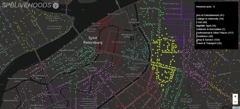
The “SPb Livehgoods” project by QULLAB laboratory is dedicated to studying vernacular regions of the city by using data that is generated by internet users. According to Artem Konukhov, a programmer and employee of QULLAB, they use the Livehoods algorithm to identify clusters with most spatial and social connections, which they defined as vernacular regions, i.e. regions that are shaped by not just geographic proximity but also social likeness. They used data from VK, foursquare, 2GIS, and social polling, and applied an automated algorithm for clustering data on user check-ins in different venues.
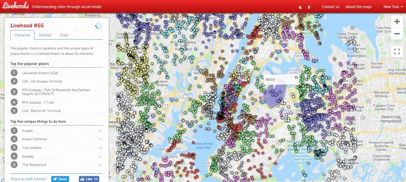
The results were validated with the help of a sociological study and an analysis of pedestrian connectivity. It’s worth mentioning that apart from social likeness, vernacular regions also have common functional specificity, i.e. the type of venues that form a cluster. One can describe such regions as tourist, artistic, culinary and so on. This way, the algorithm helps identify the regions of a city with opportunities for organizing local communities and partnerships between small enterprises. You can check out the map of St. Petersburg vernacular regions here.
“To my mind, the practical relevance of this research has to do with consolidation of districts’ populations. If a person knows more about the place they live in and associates themselves with it, it can contribute to developing a sense of identity. Also, there can be potentially useful results in what has to do with city administration: for example, in some cases, a vernacular region is composed of two different administrative units. Apart from developing a sense of identity, the prospects of developing tourism and the real estate sector are important, as well. Finally, our results can help understand demand from the geomarketing standpoint,” explains Artem Konukhov.
Another research that has to do with studying vernacular regions is conducted by specialists of MLA+. “Undiscovered St. Petersburg” is a research on what exactly the city is composed of, on the different types of urban tissue and its actual, i.e. vernacular regions. One of the project’s goals is to get an insight into the ways for intensifying the use of developed areas as an alternative to urban sprawl. Another important goal is to map the city with regard to its development and not the administrative division.
Applications
During the second part of the seminar, experts discussed the functionality of vernacular regions of St. Petersburg and other cities, as well as the benefits from studying such territories.
According to Alexandra Nenko, such objects as theatres, museums or other landmark long-standing objects are the established point of attraction for citizens and tourists that contribute to the stability of their associated vernacular regions.
“Research on vernacular regions can help identify the places that representatives of particular subcultures are attracted to. For example, we analyzed data from VK to learn which locations have most check-ins from similar users. Those were theatres. Surely, we will have to check these results, but by the looks of it we were right. It might be a good idea to continue this research and identify places that attract theatre enthusiasts, hipsters, classical music lovers and so on,” says the expert.
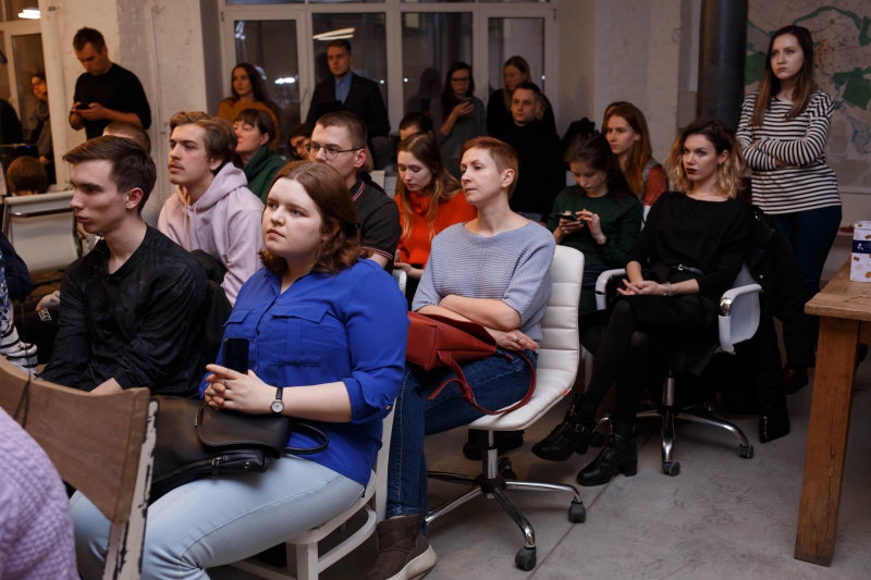
She adds that research on vernacular regions can also be used for better management of the civilian sector, non-profit organizations, and such establishments as schools and kindergartens. Then again, the latter have particular restrictions that are associated with particular administrative units.
Finally, one more prospect has to do with instruments for the development of small businesses. For example, data and research on social interactions and citizen activities can be used by different venues in creating efficient advertising or offering better services.
