Okhta, a historic district on the right bank of the Neva River, is named after the Okhta River, which flows into the Neva. The area on its left shore is called Malaya (Little) Okhta, and on the right, guess what – Bolshaya (Big) Okhta.
The history of this area is older than St. Petersburg itself. In 1611, the Kingdom of Sweden established the town of Nyen, along with the fortress Nyenschantz, here. In 1703, during the Great Northern War (1700-1721), it was surrendered to Russia. It was at the same time that Peter the Great was looking for a starting point for the nation’s new capital. The new territory was considered, but eventually, the nearby Hare Island was chosen, and Okhta became an outskirt for centuries.
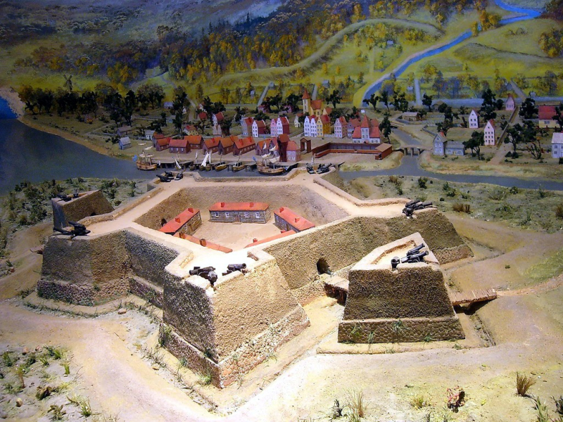
A model of the Nyenschantz Fortress. Credit: Evgeny Gerashchenko, CC BY-SA 2.5, via Wikimedia Commons
A couple of decades later, it became home to many carpenters and craftsmen brought from across the regions to build the Baltic fleet for the new city. By the 19th century, it was still an isolated location built up with wooden houses and industrial buildings, including shipyards. It wasn’t until 1911 that a bridge finally connected Okhta to the mainland, and the district began its transformation into a residential area.
Today, it’s a lively neighborhood shaped by Soviet architecture with traces of the earlier past. We won’t try to embrace everything in one go – instead, we’ll narrow the route to the Malaya Okhta, where there’s still a lot to discover!
Walking around
Start your journey at the Novocherkasskaya metro station – with 12 exits, it’s easy to get lost. Take exits 3 and 4, and above the ground, you'll find yourself in the symmetrical Zanevakaya Square. But the first sight on our way is neither a building nor a park, it’s a shawarma spot! The fast food joint U Zakhara has been around since the 90s, and still draws visitors from all over the city for its falafel and shawarma. So, heading here hungry may actually be a good idea.
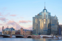
At the next stop, we’ll catch a glimpse of contemporary architecture. Near Malookhtinskaya Embankment, you’ll spot two office buildings of peculiar shape. The big glass one, St. Petersburg Plaza, is often compared to a kettle, and the boxy one across the road has the nickname “toaster.” The two buildings fall under the architectural style known as capitalist romanticism, which carries an ironic tone. It stems from the post-Soviet freedom of urban planning that untied the hands of architects and resulted in bold, but mostly quirky projects. The nearby Uspenskaya Church adds to the contrast. Overall, it’s definitely the kind of place where you can snap a few cool photos.
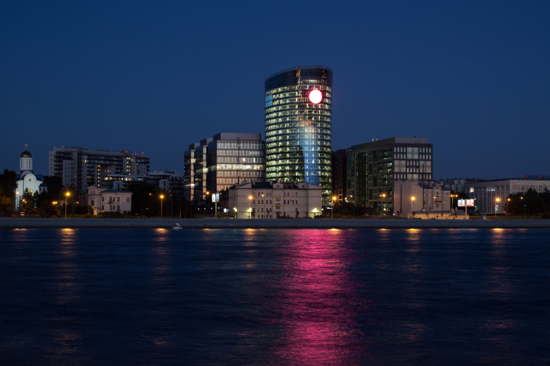
St. Petersburg Plaza. S Petr, CC BY 3.0, via Wikimedia Commons
If you love gloomy aesthetics, visit the Malookhtinskoye cemetery next. This small piece of land tucked between residential blocks belonged to Old Believers, a religious denomination that was common among those craftsmen. Among the gravestones, you’ll find some unusual examples – like the one that uses only symbols, not text, to describe the person's life.
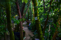
To liven up the route, drop by Design District DAA. The massive building once housed a mechanical engineering design office. Nowadays, it’s a hotspot for creative businesses, architects, showrooms, and galleries with over 150 residents. There’s always an exhibition or workshop happening; check their social media for the schedule.
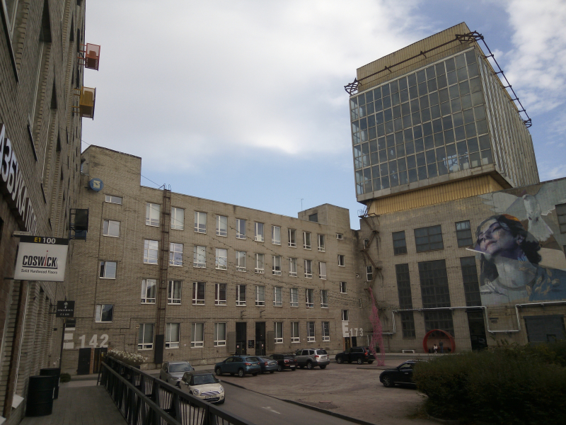
Design District DAA. MBH, CC BY-SA 4.0, via Wikimedia Commons
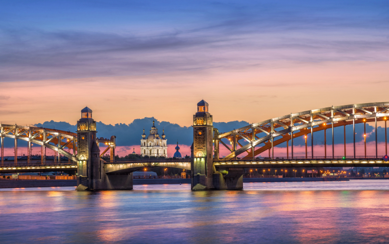
Head towards the embankment and you’ll see an impressive arch bridge. It’s the Bolsheokhtinsky Bridge, the area’s first connection with the city center. Its gothic look has turned it into a movie backdrop, including scenes from the Soviet adaptation of Sherlock Holmes. It’s also a great viewpoint for the Smolny Cathedral. Nearby lie the excavations of the old Nyenschantz Fortress – unfortunately, fenced off and closed for access at this time. Fun fact: this was the initial proposed site for the Lakhta Center, but locals successfully defended their right to an unobstructed view.
Cross the river via Komarovsky Bridge (we're entering Bolshaya Okhta for a bit) to where small shipyards used to be. Now there’s just one red brick building with a tower, the former Okhta Shipyard, now another business center.
At the final point of the route, we’re back to Malaya Okhta, into the new residential areas and their modern green spaces. At Okhta-Okkervil Park, there are outdoor sports facilities, hammocks, and swings where you can relax after your long journey. From here, it’s just a short walk back to the metro, and time to call it a day.